🇬🇷 Grecia
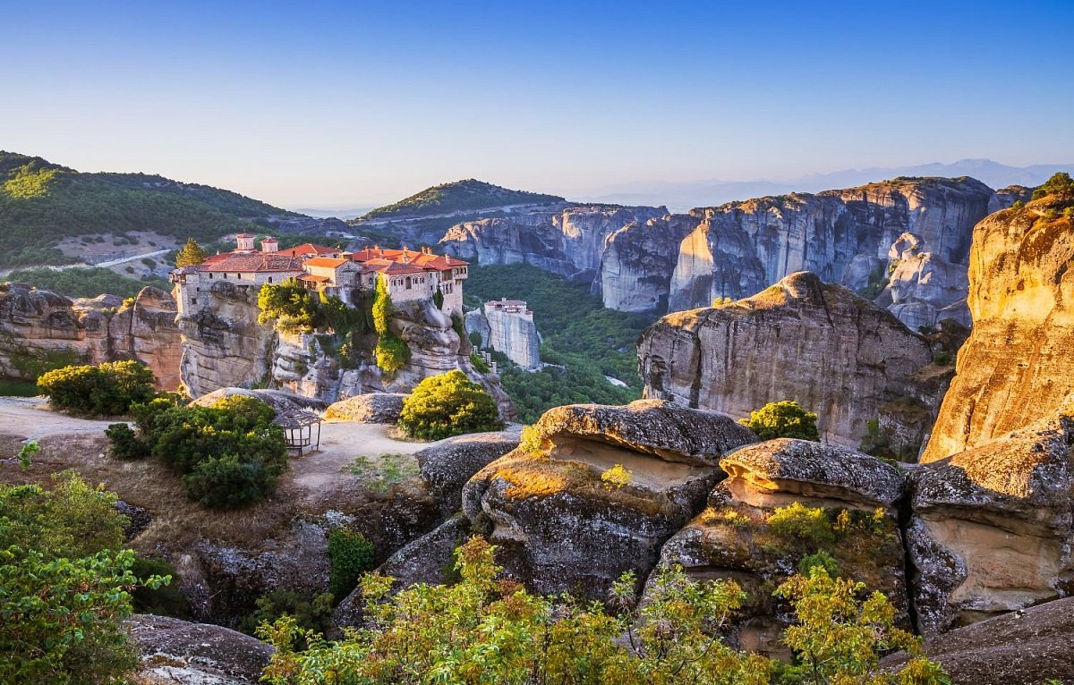
Il territorio greco è caratterizzato da montagne, colline e una vasta costa. La vetta più alta è il Monte Olimpo, la mitica dimora degli dei, alto 2.917 metri e circondato da ricche foreste e gole spettacolari. Il Paese ospita anche migliaia di isole, ognuna con un paesaggio unico, che va dalle pianure aride alla vegetazione lussureggiante. La geografia diversificata della terraferma e delle isole ne fa un paradiso per le attività all'aria aperta, come l'escursionismo, la vela e l'esplorazione di spiagge remote e antiche rovine immerse in scenari pittoreschi.
Numero vette
 21 568
Numero aree
 75
75
Geoportale / Fonte verifica
–
–
Lista catene montuose e più info disponibili solo nella VERSIONE PREMIUM.
Fonti dei dati
Il database delle montagne di questo paese si basa su queste fonti.
-
© OpenStreetMap contributors
OpenStreetMap, OpenStreetMap contributors · Open Database License (ODbL) 1.0 -
Εθνικό Γεωγραφικό Λεξικό © Γεωγραφική Υπηρεσία Στρατού, via Ελληνικό Κτηματολόγιο / data.gov.gr, CC BY 4.0
Εθνικό Γεωγραφικό Λεξικό (ΓΥΣ) - Στοιχεία τοπωνυμίων, Γεωγραφική Υπηρεσία Στρατού (HMGS), via Ελληνικό Κτηματολόγιο · Creative Commons Attribution 4.0 (CC BY 4.0) -
produced using Copernicus WorldDEM-30 © DLR e.V. 2010-2014 and © Airbus Defence and Space GmbH 2014-2018 provided under COPERNICUS by the European Union and ESA; all rights reserved. The organisations in charge of the Copernicus programme by law or by delegation do not incur any liability for any use of the Copernicus WorldDEM-30.
Copernicus DEM GLO-30, European Space Agency (ESA), Copernicus programme of the European Union · Licence for the use of the Copernicus WorldDEM-30 -
Ονόματα τριγωνομετρικών σταθμών © Γεωγραφική Υπηρεσία Στρατού
Τριγωνομετρικά σημεία Ελλάδας (station names), Γεωγραφική Υπηρεσία Στρατού (HMGS)